DATA: united kingdom: raster map products
Introduction
Raster
data, holds continuous images - such as map scans, aerial photographs or satellite imagery - for discreet (generally tiled) areas and is most commonly used in a
geographic information system
as a backdrop to
vector
data.
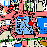
© Copyright
Bartholomew
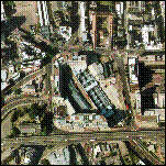
© Copyright
Cities Revealed
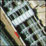
© Copyright
Cities Revealed
The leading providers of topographic data in raster format for the United Kingdom are:
Automobile Association
Bartholomew
George Philip
Ordnance Survey
The leading providers of aerial photography and satellite imagery (respectively) are:
Cities Revealed
National Remote Sensing Centre
Follow the links for product and pricing details.
© Copyright Business Geographics Limited